The European Union wants to significantly strengthen the protection and restoration of forests, especially native and old-growth forests, by 2030. The introduction of integrated monitoring plays a crucial role, which will allow for precise monitoring of the state of European forests. Researcher Juan Alberto Molina from the Czech University of Life Sciences is also contributing to improving the collection and processing of data on the maturity and health of forests as part of the MERIT program of the Central Bohemian Innovation Center.
What is the specific objective of the European Agreement, which focuses on the protection of forests?
According to this strategy, which is part of the Green Deal, the European Union should protect 30% of its territory by 2030. It is expected that a large part of the newly protected areas will be forests. Currently, only 10% of old-growth forests are protected in Europe. The most important are the original virgin forests, which make up only 3% of the forested area in the EU. These should be completely included in the most strictly protected areas.
What are you doing in your research?
I determine the characteristics of the forest, whether it is young or old, monoculture, homogeneous or heterogeneous, and so on. All these elements together form the so-called naturalness of the forest. We can imagine it as certain phases or states. From the initial regeneration, when growth is just beginning, to the last phase, when the trees are very old. Such forests are found, for example, in Jeseník. I try to monitor these states and to do this I use various indicators, including the distribution of trees, i.e. the structure.
If trees of different sizes are found together, these are heterogeneous forests and this is a sign of a very old stand. On the contrary, forests are homogeneous, in which we find trees of similar height. Another indicator can be the existence of different tree species. However, I mainly focus on Norway spruce, as it is a very important and widespread species in the Czech Republic. In the Czech Republic, I study forests where spruce is at least the dominant species.
Can the terms homogeneous and heterogeneous forest cover other characteristics, not just the size of the trees?
Yes, that was just one example. Another characteristic is, for example, their health status. We can compare forests and trees to people. When we are babies, we are very small in stature, we are healthy, we have better skin. When we are old, our skin is worse, our health is no longer serving us so well. And something similar happens to trees. We can also measure their health and then estimate their age using certain key parameters. And that is what I am trying to do.
I use my own software
How do you obtain data for these indicators?
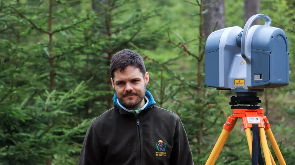
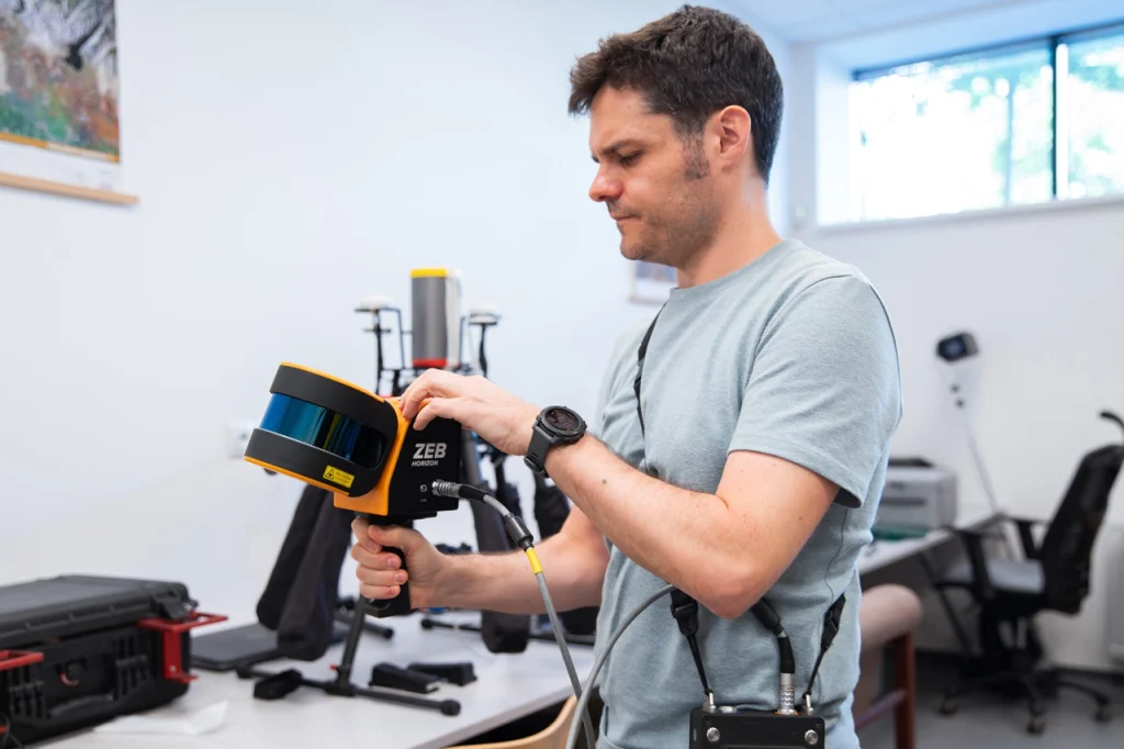
I walk through the forest and of course I use various tools. Some are conventional, like bands or hypsometers to determine the dimensions of trees, but I also apply remote sensing technologies – ground-based laser scanners that detect and measure light, so-called LiDAR, which is a very promising technology in forestry today. It is also used to scan the Earth from airplanes or even from satellites, but I physically only work with the ground-based one, because it is easier to manipulate in the field. Using LiDAR, I then collect data on the structure of the forest. We are talking about a large amount of collected data here, millions of points.
What happens to them afterwards?
I have to process this large data set in its entirety, which is a difficult task. There are several software solutions, but unfortunately it is impossible to choose one that is the best, so they are usually combined. That is why I developed my own software, the so-called R package called FORTLS. In addition, I also use, for example, Python libraries that can complement my software solutions. Using these technologies, I obtain the parameters of the tree – its position, dimensions, diameter, volume, etc.
What are these parameters for?
For example, volume can be used to estimate the carbon stock in wood or the height of a tree. This information, which is essentially a tree-level parameter in space, can be used to estimate some other indicator related to forest structure, such as its heterogeneity.
Old forests, modern tools
So what is the final output of your work?
The result is a very accurate 3D model with the overall structure of the forest and its measured properties. I create powerful models based on a deep learning algorithm that can be used in the Czech Republic. For example, using the “forest regeneration” model, which has achieved very good results, we can see how the growth of new trees varies depending on the age of the forest. In the young one, we can expect greater regeneration than in the old one.
We also train deep learning models on a test set of experimental data that focuses on the complexity of forest structure. The captured spectrum is divided into thematic layers, which we assign to each point in the 3D point cloud. Each layer represents certain components, such as leaves, branches, trunk, stem, soil, undergrowth, regeneration. Thanks to this model, I can then estimate what to expect from different forest states. We can also observe the change in structure over time and look at its state more than 200 years ago, for example, which is a great achievement.
How are these models used in practice?
The result of my work is important for the goals of the New EU Forest Strategy , which is dedicated to monitoring forests in terms of biodiversity, water quality, recreational use and much more. Furthermore, the models will be available, for example, to the National Forestry Institute.
Why do we need to develop a new methodology?
New, more accurate methodologies for detecting and monitoring forest types need to be developed so that we can at least conserve the oldest forests we still have left.
In order to be able to obtain a comprehensive picture of the state of vegetation, it is necessary to link and integrate terrestrial and satellite technologies: remote sensing technologies, including ground-based approaches, and satellite systems, such as those provided by the Copernicus and Landsat programs, which offer optical imagery and other valuable data products over large areas.
How do you put the individual pieces of information together?
To this end, I completed a fellowship at the University of Edinburgh, where I focused on linking my own ground-based LiDAR measurements with satellite data. However, this proved to be a challenging task. I only had a few dozen plots available, which was not enough to calibrate the satellite data or to develop a reliable methodology. A nationally applicable approach requires data from thousands of plots. In order to effectively combine ground-based and satellite data, each plot must be linked to precise geographical coordinates. However, I was unable to obtain the precise coordinates of the plot. The National Forestry Institute has this data, but access to it is restricted.
So I tried to get data from Spain, where I come from. I managed to get a valuable file with thousands of plots and precise coordinates, which are key for training different types of models. I therefore adjusted the research plan and finally trained the models on Spanish data. I focused on carbon stocks in the forest, which is one of the topics of the Edinburgh research and can also serve as an indicator of the naturalness of the forest. The collaboration with Steven Hancock, who is one of the leaders in the field, was also a great benefit for me. Thanks to this, I am now bringing new knowledge back to the Czech Republic.
Can this model, trained on data from Spain, also work for Czech forests?
Yes, it should work for any type of forest, for any latitude. The model that I’m using now from Edinburgh was actually trained and adapted for use in Africa, Zambia and other surrounding countries that I’ve traveled to as part of another project. To see how robust our model is, we decided to train it on other latitudes and forest types. When applied to Spanish forests, we get very good results in terms of carbon stock estimates.
From Spain to the Czech Republic
How did you find out about the MERIT program?
At the Faculty of Forestry and Wood Science at the Czech University of Life Sciences (CZU), where I used to work, I saw a poster about the MERIT program. I started researching and found out that it was a very good program. I contacted my potential future supervisor, Vítek Moudrý, and we discussed my ideas and whether I could join their team at the Faculty of Environment at CZU.
So before the MERIT program you already worked at the Czech University of Life Sciences in Prague. How did you get to the Czech Republic?
In 2022, I was finishing my PhD in Spain and wanted to travel abroad. I was looking for postdoc positions and came across a job offer from the Faculty of Forestry and Wood Science, ČZU on Twitter. After two years, I received another postdoctoral scholarship from a Spanish foundation, and then the MERIT program at the Faculty of Environmental Science came along. I am in my second year of this program, and I will graduate in December 2026.
Do you already have plans for the future?
Nothing is certain yet, but we have won a project under the Horizon Europe programme. It focuses on predicting the maximum amount of carbon that forests can store, depending on the location. The new EU strategy also emphasizes strengthening the role of forests as natural carbon sinks – increasing the resilience of forests and their ability to bind carbon, which should contribute to reducing emissions. This is also related to my current work, which is the protection of original and old forests, as they are more efficient at absorbing carbon.
With this project, I will probably return to my original Faculty of Forestry and Wood Science at ČZU. The transition between faculties is often an obstacle at some universities, but not here, and I consider it a personal success that I have built a bridge between the two faculties over the years at ČZU. I think it was beneficial and we can now cooperate better. For me, the most important thing is the research itself, I want to develop good science with useful methodologies.
I am also considering trying my luck in the private sector. Sometimes it is necessary to move on, as academia often requires a high degree of mobility, which may not be compatible with maintaining a healthy work-life balance.
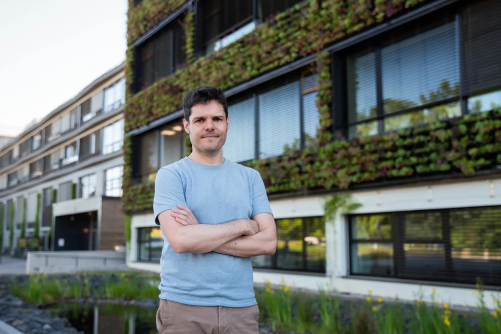
I feel at home here.
What is the team at CULS like compared to others you have worked in?
The biggest advantage I consider is the openness of our team and the entire department. My colleagues are always willing to discuss my ideas with me, even if we are currently working on a different topic. I have not encountered such an approach anywhere else. My manager gives me a lot of freedom, which is also great. A friendly and safe working environment is also important to me, which makes me feel at home here.
What advice would you give to students? How to become the best researcher, scientist?
There is no simple answer to this. It is a combination of several factors.
It is essential to have a good supervisor who guides, motivates and helps you develop your potential. Science is all about people, and I was lucky to have supervisors who gave me freedom and trust. You have to believe in yourself, explore new possibilities, and be willing to collaborate across disciplines. Everyone sees a problem differently, and different perspectives often lead to better solutions.
Flexibility is also important, because you never know when and where new methods will find practical use. In science, therefore, it is often not only what you discover that matters, but also whether you make the discovery at the right time. Science is also very much about luck. You can be a good student, but if you are not in the right place at the right time, success may not come so easily. It is equally important to be able to relax, because many good ideas arise precisely when you allow yourself to slow down.
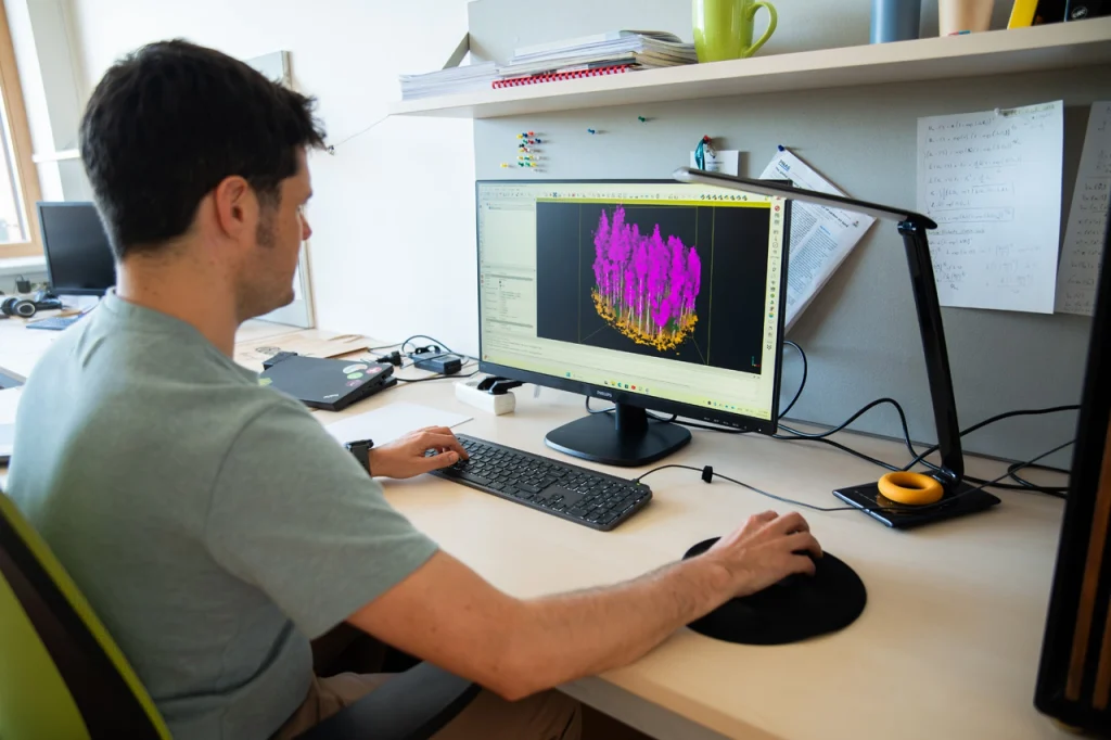
Juan Alberto Molina is a researcher at the Czech University of Life Sciences in Prague and a MERIT Fellow. His project focuses on monitoring forest maturity using remote sensing technologies, a key technology for better planning of forest management policies and strategies for adapting Czech forests to the impacts of climate change.
In addition, this project promises positive externalities for forestry companies in the form of open-source software designed for processing and analyzing data from ground-based laser scanning devices, which are considered one of the technologies with the greatest potential for improving forest inventories.